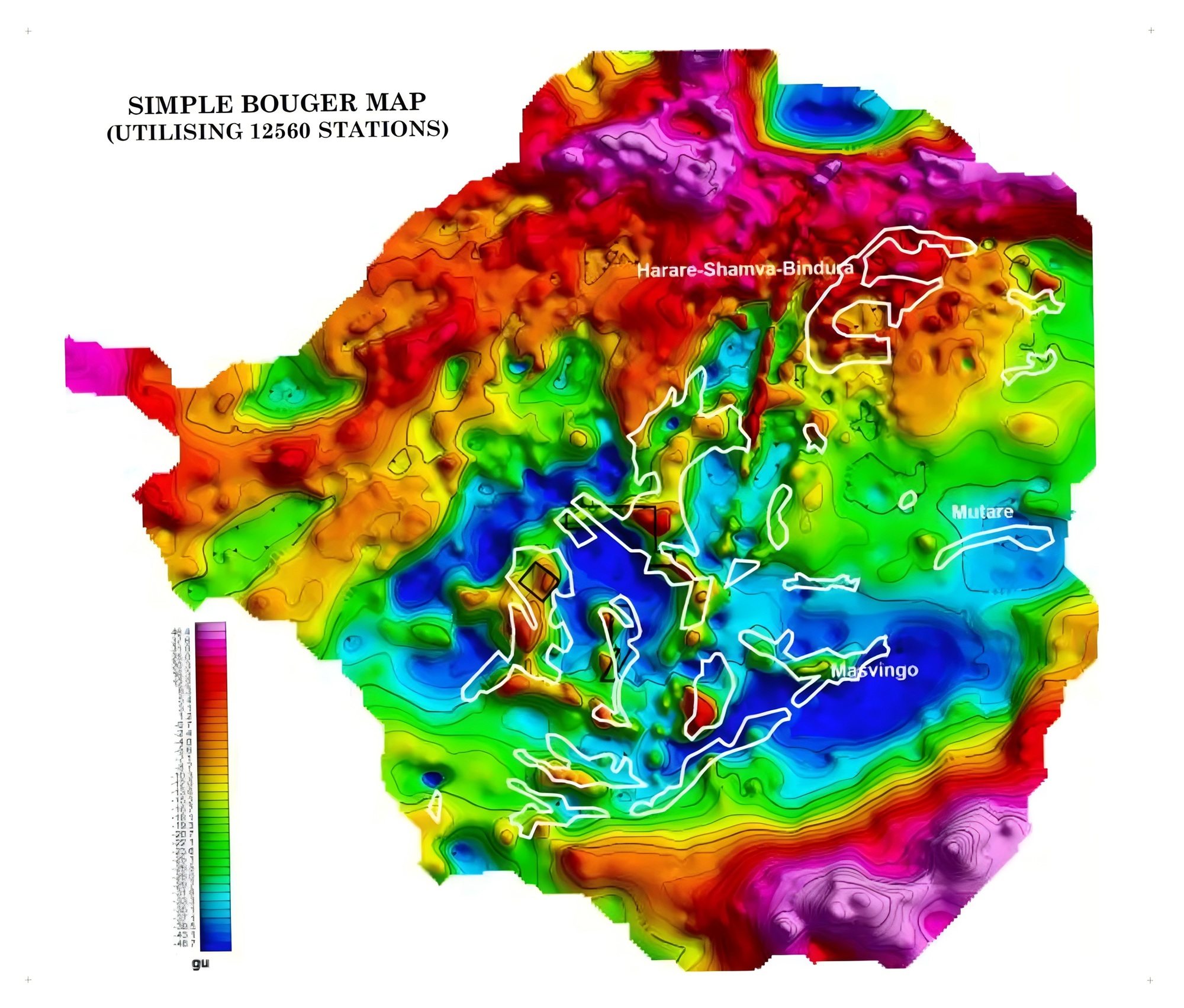
At an exploration site, the most common problem is often not a lack of anomalies—it is too many anomalies. A geochemical map may contain multiple high-value zones, while a geophysical survey may show magnetic, resistivity, gravity and chargeability anomalies at the same time.
The real questions are which anomalies are related to mineralization, which reflect background geology or surface interference, and which justify reconnaissance, sampling, infill geophysics or drilling.
Exploration geologists often say that geochemistry “looks directly for ore” while geophysics “looks indirectly.” The distinction is useful: geochemistry follows the material released or redistributed by a mineral system, whereas geophysics detects the physical-property contrasts created by underground rocks and structures.
Geochemistry provides material evidence. Geophysics provides the spatial framework. High-quality targeting comes from testing both within one mineral-system model.
GAIA’s role is not simply to overlay maps. Its AI identifies geological logic, relationships among anomalies and target priority, helping teams move from seeing an anomaly to judging a plausible orebody.
PART 01
Why geochemistry is more “direct”: it tracks the material footprint of mineralization
Geochemical exploration is direct because it measures the chemical constituents of mineral systems. During ore formation, weathering and erosion, metals and pathfinder elements do not remain confined to the orebody. Hydrothermal alteration, faulting, leaching, groundwater transport and sedimentation can disperse them into primary halos, secondary halos and downstream dispersion patterns.
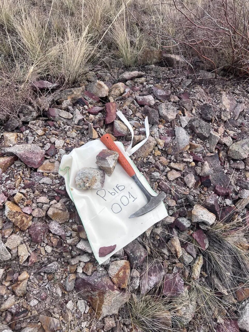
A vein only a few metres wide can therefore produce a geochemical footprint covering several square kilometres. Soil surveys commonly sample the near-surface interval, yet can resolve subtle changes in element concentration; under suitable hydrogeological conditions, hydrogeochemical plumes may extend far beyond the source.
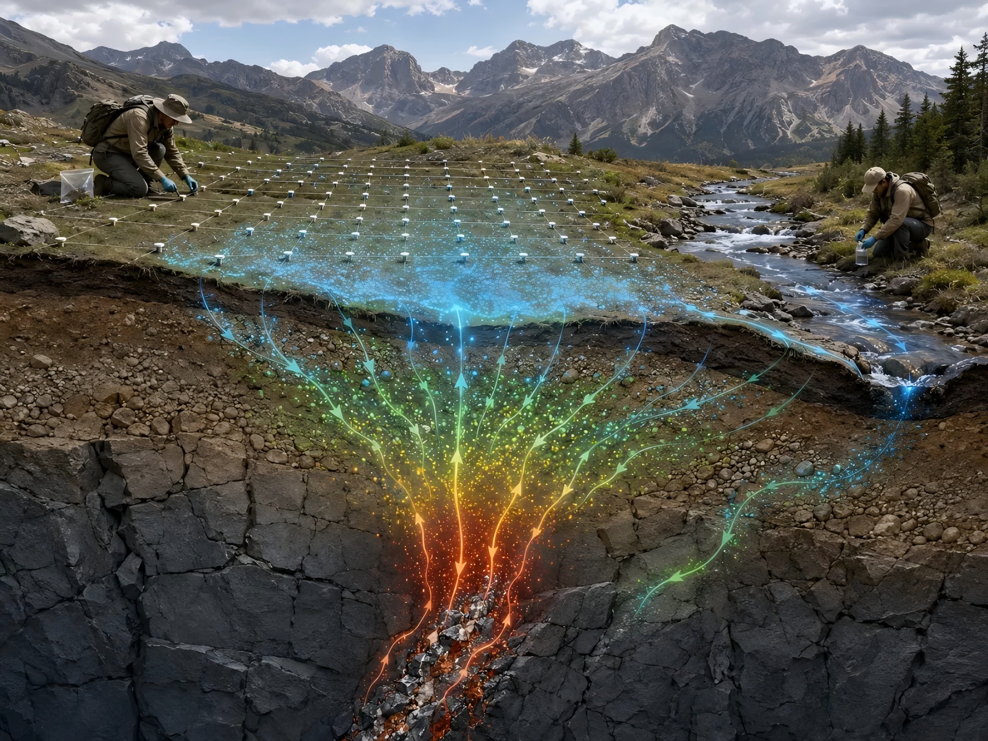
Combinations such as Cu–Pb–Zn–As–Sb–Hg are often more meaningful than an isolated high value. Together they may form a material evidence chain linked to mineralizing fluids, structural pathways and the centre of a mineral system.
Geochemistry also has limits. Thick cover, intense weathering, surface-water redistribution and human contamination can shift, overprint or mask anomalies. It is strong at identifying material affinity, but it cannot always locate the orebody in three-dimensional space.
PART 02
Why geophysics is more “indirect”: it maps changes in the physical field
Geophysics does not measure ore elements directly. It measures contrasts in density, magnetism, conductivity, resistivity or seismic velocity. Magnetic surveys respond to magnetic susceptibility; gravity surveys to density; electrical and electromagnetic methods to conductivity; and seismic methods to velocity boundaries and structural changes.
That gives geophysics powerful spatial reach. Ground-penetrating radar can resolve shallow features at high resolution, resistivity methods can investigate tens to hundreds of metres, magnetic data may trace favourable bodies to kilometre scale, and seismic methods can image much deeper structures where cost and field conditions allow.
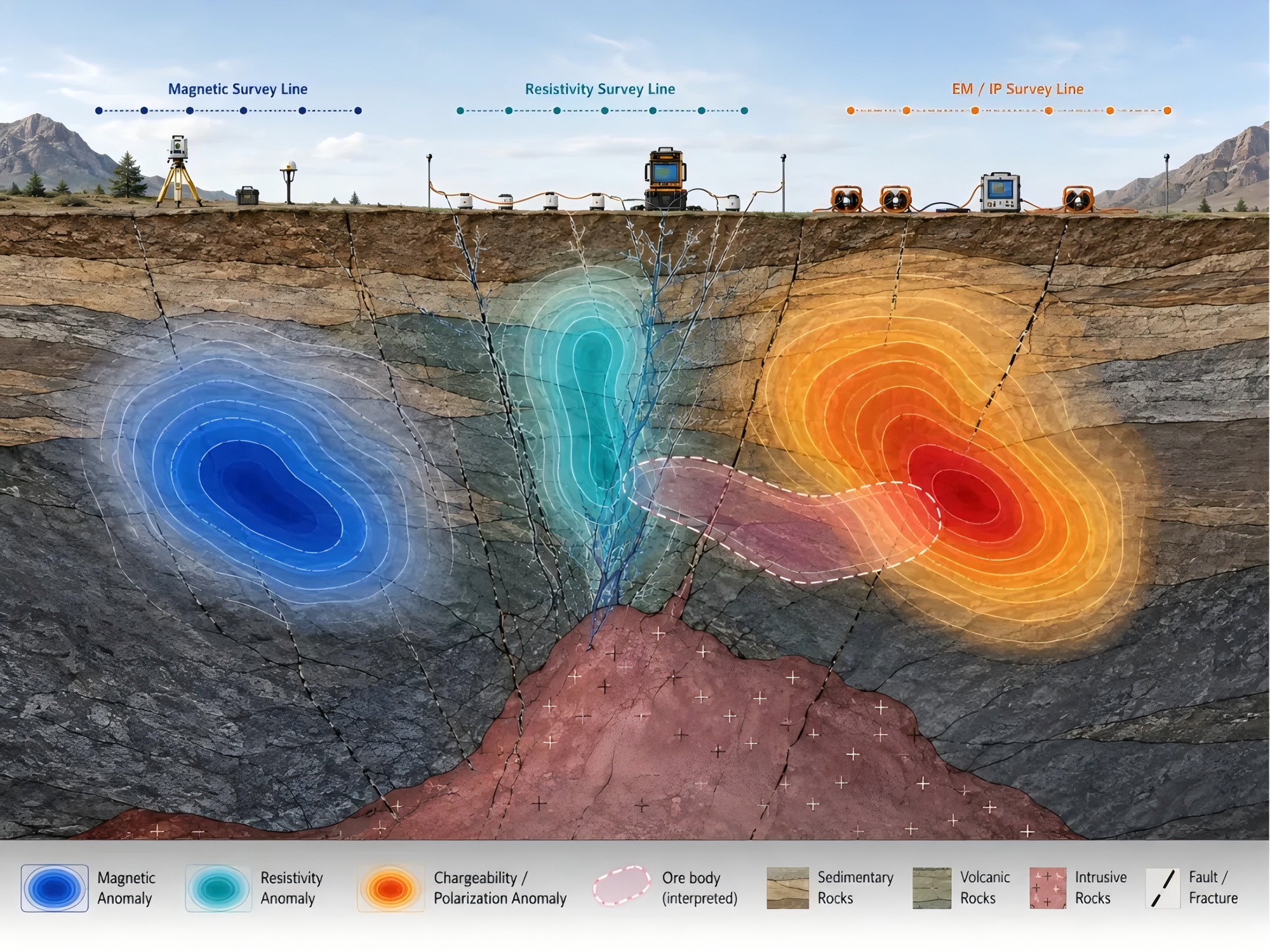
The central challenge is non-uniqueness. A magnetic anomaly may reflect magnetite mineralization or a mafic intrusion; a gravity high may indicate dense ore or merely a change in lithology. Inversion is not a unique solution, and noise, line spacing, topography and geological assumptions all affect the result.
Geophysics therefore supplies spatial evidence, not an orebody conclusion. Its anomalies must be checked against geochemistry, alteration, mapping and known mineral occurrences.
PART 03
Effective exploration requires material evidence and spatial evidence to work together
Modern exploration should not treat “direct” geochemistry and “indirect” geophysics as competing approaches. Geochemistry asks whether mineralizing material and pathfinder elements are present; geophysics asks whether favourable underground structures and physical hosts exist.
A target becomes materially stronger when geochemical anomalies, geophysical responses, remote-sensing alteration, structural architecture, intrusive contacts and known mineralization all show a coherent spatial relationship.
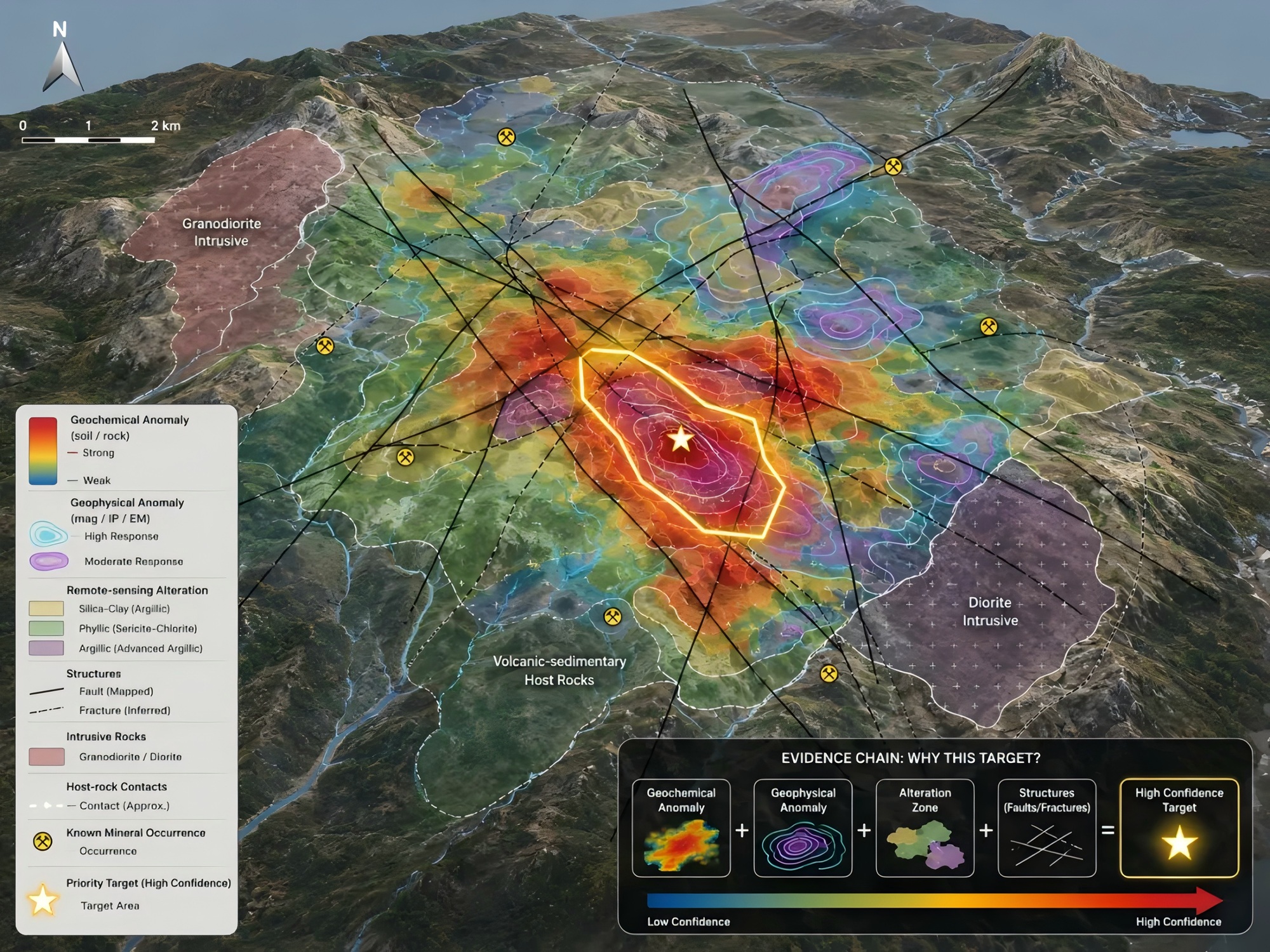
For porphyry copper-gold, skarn, orogenic gold and polymetallic systems, no single indicator is decisive. Confidence increases when lithology, faults, alteration zoning, multi-element signatures and magnetic, IP, resistivity or gravity responses align with a realistic deposit model.
PART 04
What GAIA AI does: convert anomaly maps into target rankings
In conventional workflows, geochemical, geophysical, remote-sensing, mapping and drilling data often sit in different software, coordinate systems and interpretation teams. Considerable time is spent cleaning, registering and comparing layers, and subtle spatial relationships can be missed during early screening.
GAIA AI turns these fragmented sources into a computable, explainable and rankable evidence chain. It standardizes coordinates and anomaly scales, grids spatial data, extracts features and identifies relationships among element associations, geophysical responses, fault intersections, intrusive margins, alteration zones and known mineralization.
For each potential target, the system evaluates geological favourability, geochemical intensity, geophysical fit, remote-sensing alteration, structural controls and historical exploration clues.
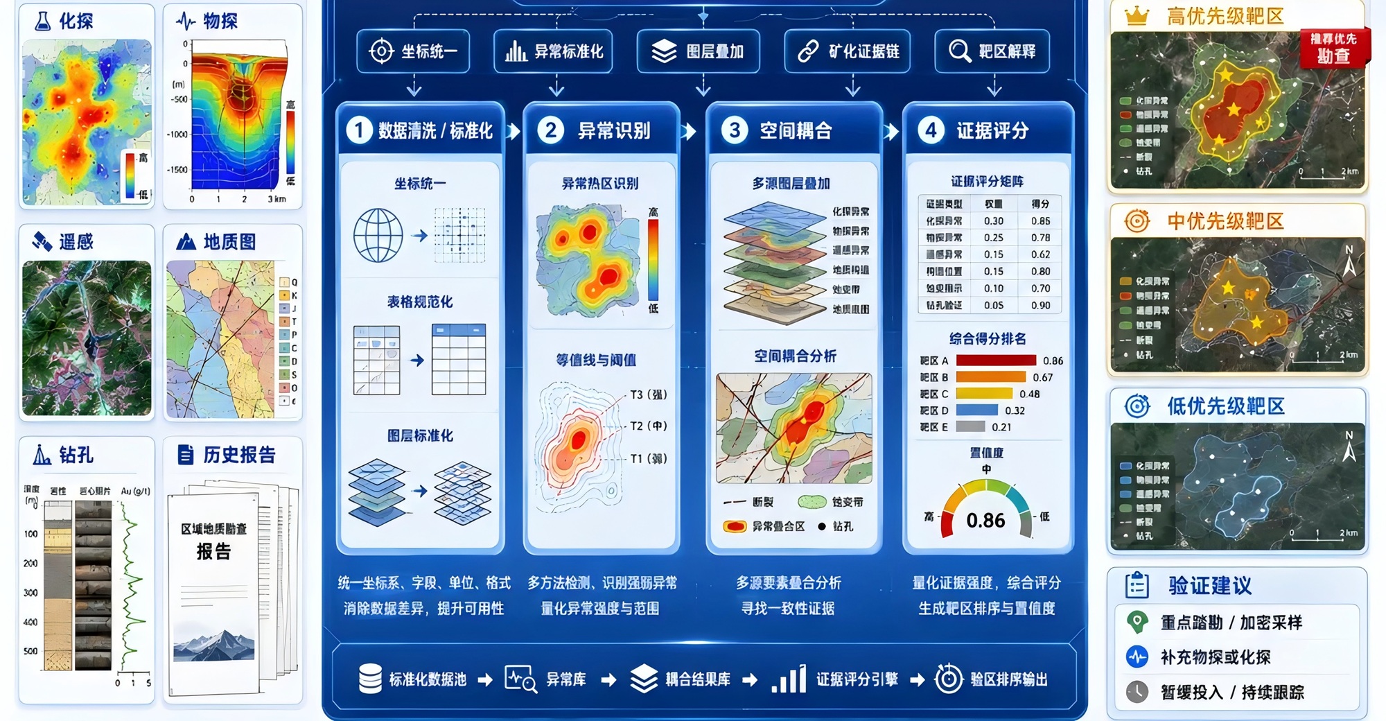
The output is not a black-box score. Each recommendation is explained through geological basis, geochemical evidence, geophysical response, spatial coincidence and the proposed validation step—whether reconnaissance, sampling, infill geophysics or drilling.
PART 05
How GAIA AI supports target selection in a real project
GAIA AI does not usually declare that a site “definitely contains ore.” It creates a traceable target-selection process. First, it identifies the regional metallogenic setting from geological maps, mineral occurrences, tectonic architecture, magmatism and historical exploration.
Second, it screens single-element and multi-element geochemical signatures. In gold and polymetallic exploration, relationships among Au, As, Sb, Hg, Cu, Pb and Zn may reveal fluid activity and zonation more reliably than one isolated maximum.
Third, it matches magnetic, resistivity, chargeability and gravity anomalies with faults, intrusive boundaries, alteration and known mineralization. Fourth, it classifies targets as high, medium or low priority according to evidence consistency.
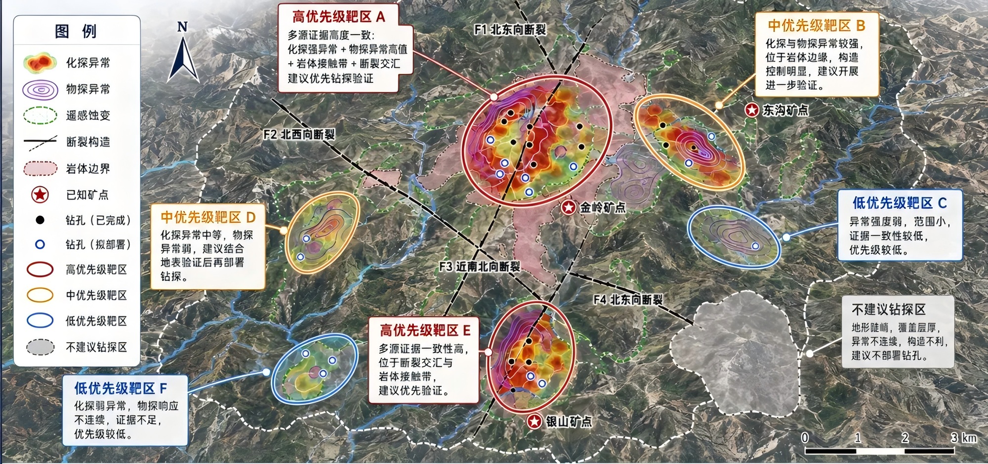
Finally, the system proposes the next action. High-priority targets may move to focused mapping, infill sampling or drill testing; medium-priority targets may require additional geochemical or geophysical data; low-priority areas can be deferred to protect early-stage capital.
PART 06
GAIA’s methodology: AI as a geologist’s second decision system
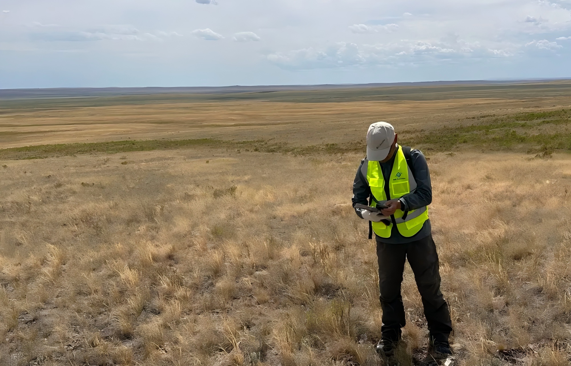
GAIA does not treat AI as a replacement for geologists. Mineral exploration depends on field observation, geological experience and engineering verification. AI adds value by recognizing patterns in complex, multi-source and nonlinear datasets, reducing repetitive work and improving screening efficiency.
The system can identify metallogenic belts, structural pathways and intrusive boundaries; distinguish background, contamination and mineralization-related geochemical signatures; constrain geophysical ambiguity; and integrate historical occurrences, alteration and drilling into a target ranking.
In that sense, GAIA AI is a second decision system: it makes the reasoning process more systematic, transparent and reviewable, while geologists remain responsible for final interpretation and field validation.
PART 07
From direct exploration to intelligent exploration: the future is evidence fusion
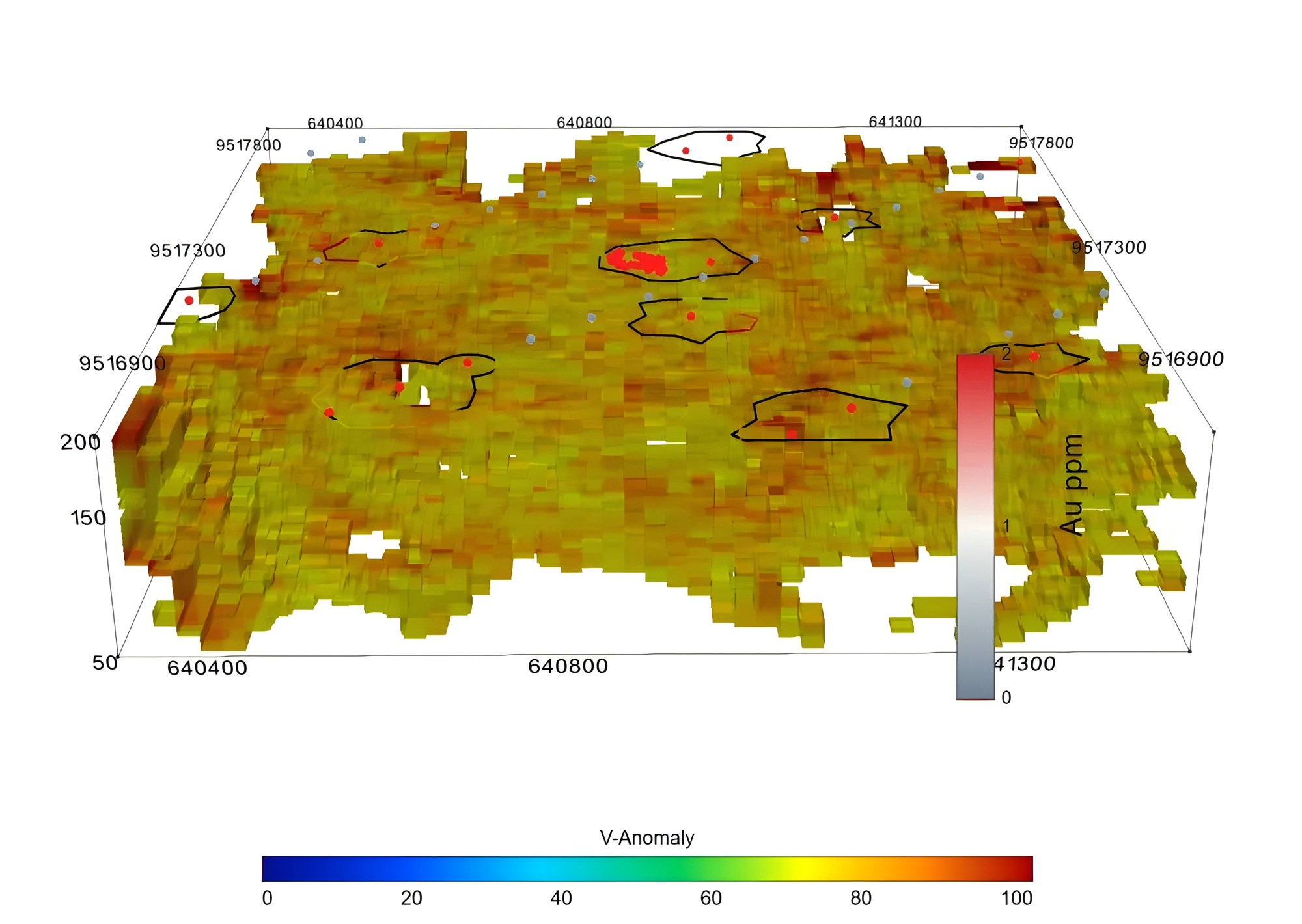
As shallow and easily recognized deposits become scarcer, exploration is moving deeper, beneath cover and into more complex geological environments. A single geochemical dataset may be limited by cover and migration pathways; a single geophysical dataset may be limited by inversion ambiguity and physical-property interference.
Breakthrough exploration therefore requires the material evidence of geochemistry, the spatial framework of geophysics, alteration recognition from remote sensing, geological deposit models and the computational power of AI to work together.
Geochemistry asks, “Is there evidence of mineralizing material?” Geophysics asks, “Is there a structure capable of hosting it?” GAIA AI adds, “Do these lines of evidence point to the same system, which target should be tested first, and what should the next exploration step be?”
PART 08
Conclusion
Geochemistry is closer to the material itself; geophysics is better at describing the underground framework. They are not substitutes, but two inseparable evidence systems in modern mineral exploration.
The future of exploration is not merely to detect anomalies, but to understand them; not merely to produce maps, but to form decisions; and not merely to outline prospective areas, but to build a closed loop from regional screening and target ranking to drill validation.
GAIA will continue combining geological experience, geochemical and geophysical data, and intelligent algorithms to turn dispersed signals into testable targets and complex interpretations into clear exploration pathways.